Robert Michael DiFilippo, University of the Philippines Diliman. January 2026
This blog presents selected ongoing student projects from the University of the Philippines Diliman that I currently advise through the Environmental Monitoring Laboratory of the National Institute of Geological Sciences. These projects are being carried out by senior undergraduate students in the Bachelor of Science in Geology program and are expected to be completed by June 2026. Collectively, they highlight the breadth of hydrological research being undertaken at the undergraduate level, including investigations into the impacts of climate change and land use, the role of blue-green infrastructure, and evaluations of groundwater potential and flood risk. The projects make use of widely applied hydrologic and hydrogeologic modeling tools such as HEC-HMS, MODFLOW-SEAWAT, and SWAT, demonstrating that these advanced applications can be successfully implemented by undergraduate students when provided with appropriate monitoring datasets and technical oversight. The collegial atmosphere between EML graduate students and undergraduates broadens the depth of this research.
Impacts of Land Use and Land Cover Change on Discharge in the Hijo River Basin, Mindanao: A Hydrological Assessment with the Hydrologic Engineering Center's Hydrologic Modeling System (HEC-HMS)
Ma. Christina Shane T. Castro
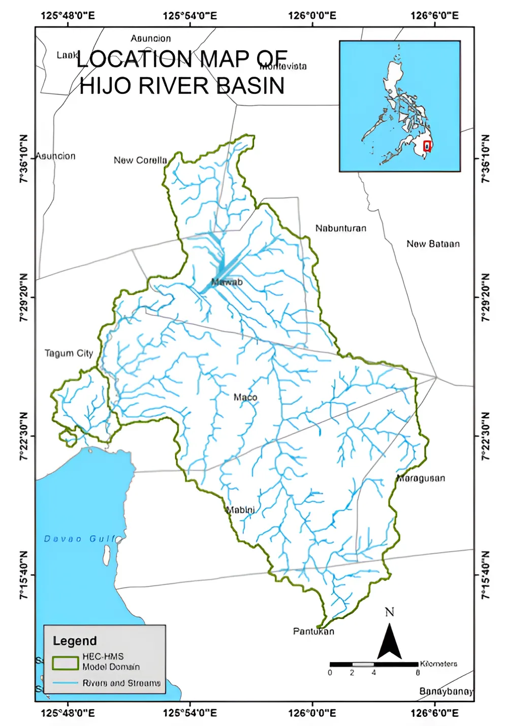
In recent years, flooding has emerged as a persistent and increasingly severe concern in many regions of the Philippines, with urbanization recognized as one of its major contributing factors. As built-up areas expand, the alteration of natural land cover significantly modifies watershed processes, often intensifying surface runoff and peak flows during extreme rainfall events. This study aims to determine how Land Use and Land Cover Change influence the hydrologic behavior of the Hijo River Basin (Figure 1)—a rapidly urbanizing watershed. By applying the Hydrologic Engineering Center's Hydrologic Modeling System (HEC-HMS), the research isolates the impact of Land Use and Land Cover Change changes by holding rainfall inputs constant across all scenarios. The output of the study is a comparative analysis of generated hydrographs, hyetographs, and peak discharge values. The results are expected to support more informed watershed management, urban planning, and flood mitigation efforts in the region.
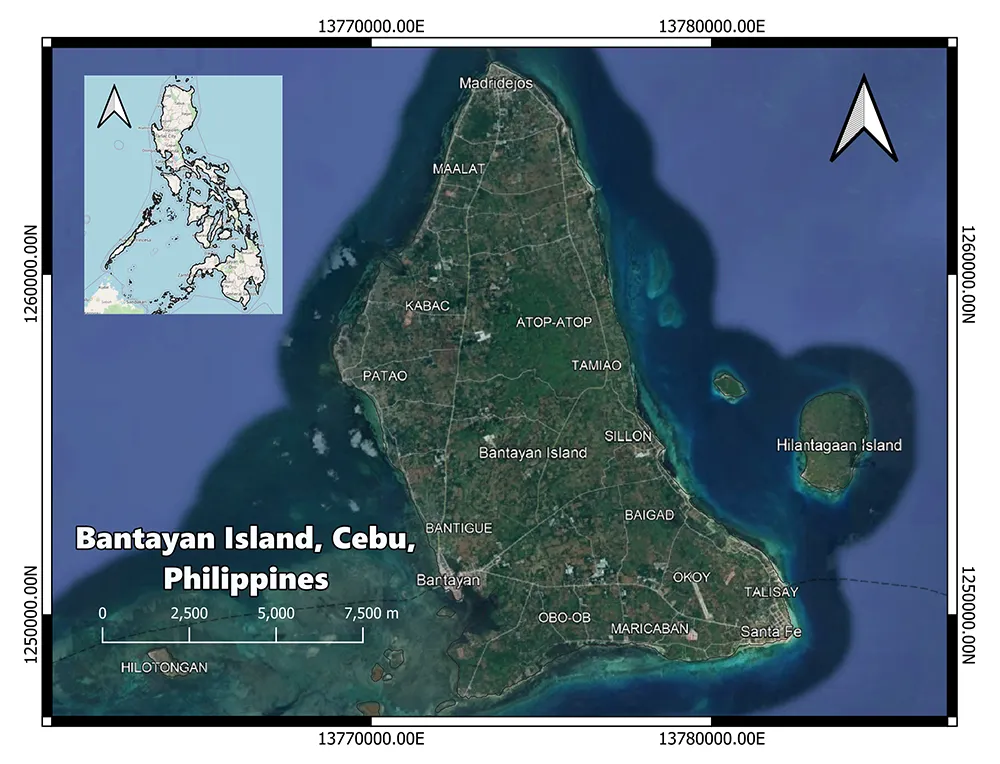
Modeling Groundwater Potential in Bantayan Island Using the Variable-Density Groundwater Flow and Transport Model MODFLOW-SEAWAT
Rachel Anne Louise B. De Guzman
Water, a fundamental need and a human right, is valuable and essential in sustaining the well-being of communities. However, the inevitable rise in population, natural forces, and climate change further exacerbate water stress. Therefore, it is crucial to assess whether an island landform can maintain its freshwater resources despite being vulnerable to over-extraction and saltwater intrusion. The modeling of groundwater potential in a portion of Bantayan Island (Figure 2) is also a step towards modeling coastal and complex karst aquifers with triple-porosity system. This study aims to develop a model that is mathematically based by using the groundwater model MODFLOW (Modular Groundwater Flow Model) and the variable-density flow and transport package SEAWAT (SEAWater And Transport) which are guided by hydrogeologic equations such as Darcy's Law and mass conservation principles. The final output of this research will serve as a guide for the local government unit and policymakers in making informed decisions in relation to water management practices.
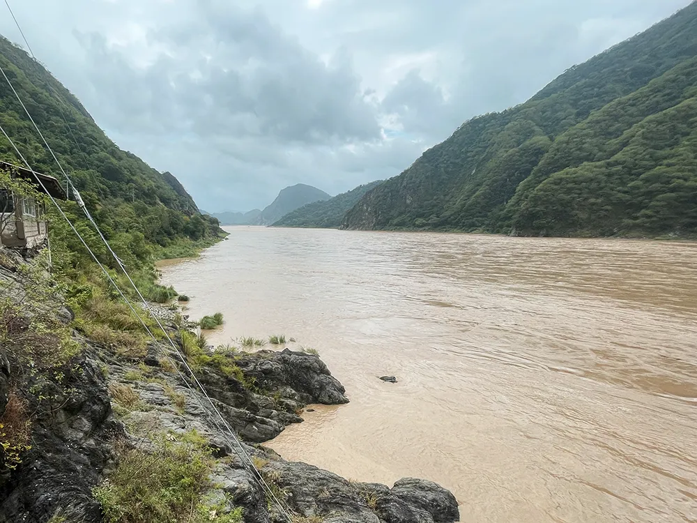
Projected Land Use/Land Cover Change and Climate Change Impacts on Hydrological Processes of the Loboc River Basin using the Soil and Water Assessment Tool SWAT
Helaena Chloe P. Dugang

Water is one of the most vital resources, used in agriculture, tourism, and energy, and by humans and biodiversity. The Loboc River Basin (Figure 3) is also used in the same way, providing water to its surrounding municipalities in Bohol, Philippines. However, watershed hydrology is threatened by climate change and land use/land cover change in which it can degrade water quality and lessen water availability. Therefore, this study aims to simulate the hydrological processes of the Loboc River Basin for the baseline (2000-2020), 2030, and 2050 in basin and subbasin scale with climate change projections and land use/land cover change scenarios, and to quantify and evaluate the projected changes in surface runoff, lateral flow, groundwater flow, evapotranspiration, and streamflow. This will be achieved through data processing and modeling in the open-source Geographic Information System (QGIS) using the the Soil and Water Assessment Tool (QSWAT) plug-in utilizing climate data from the Philippine Atmospheric, Geophysical and Astronomical Services Administration (PAGASA) and land use data from the National Mapping and Resource Information Authority (NAMRIA). Model calibration will be done under SWAT-CUP (Soil and Water Assessment Tool - Calibration and Uncertainty Program) using observed streamflow data from the Department of Public Works and Highways (DPWH). The findings are expected to reveal the hydrological response of the Loboc River Basin to scenarios under climate change-only, land use/land cover change only, and combined, and provide valuable insight into the application of the Soil and Water Assessment Tool SWAT in medium-scale basin and in a tropical climate specifically type IV climate based on the Modified Coronas Classification.
Impact of Climate Change on Streamflow and Flood Risk of Abra River Basin, Northwest Luzon using the Soil and Water Assessment Tool SWAT
Marceen Gabrielle L. Molina
The Abra River Basin (Figure 4), Northwest Philippines is one of the major Philippine basins having a drainage area of 5,125 km2. It passes through Abra, Mountain Province, Benguet, and Ilocos Sur. Previous studies show that Northern Luzon hydrologic units experience the most impact from climate change that shows an increase in peak return flow during wet and dry seasons, highlighting the stress on the hydrologic cycle of the basin. In 2023, Super Typhoon Egay or 'Doksuri' submerged one of the river's major infrastructures, the Banaoang (Old Quirino) Bridge, imposing risk of similar events in the future by extreme weather events. To bring further discussion and analysis to climate change projections to the Abra River Basin, this study will utilize the SWAT Model to determine impact of climate and management on the Abra River Basin over a continuous time period using historical and climate change scenario data. Moreover, this study will utilize GIS as a mapping tool for flood risk assessment using the climate scenarios.
Assessing the Effectiveness of Blue Green Infrastructure on Flood Mitigation in the Sta. Cruz River Basin
Jhon Irish O. Palomaria
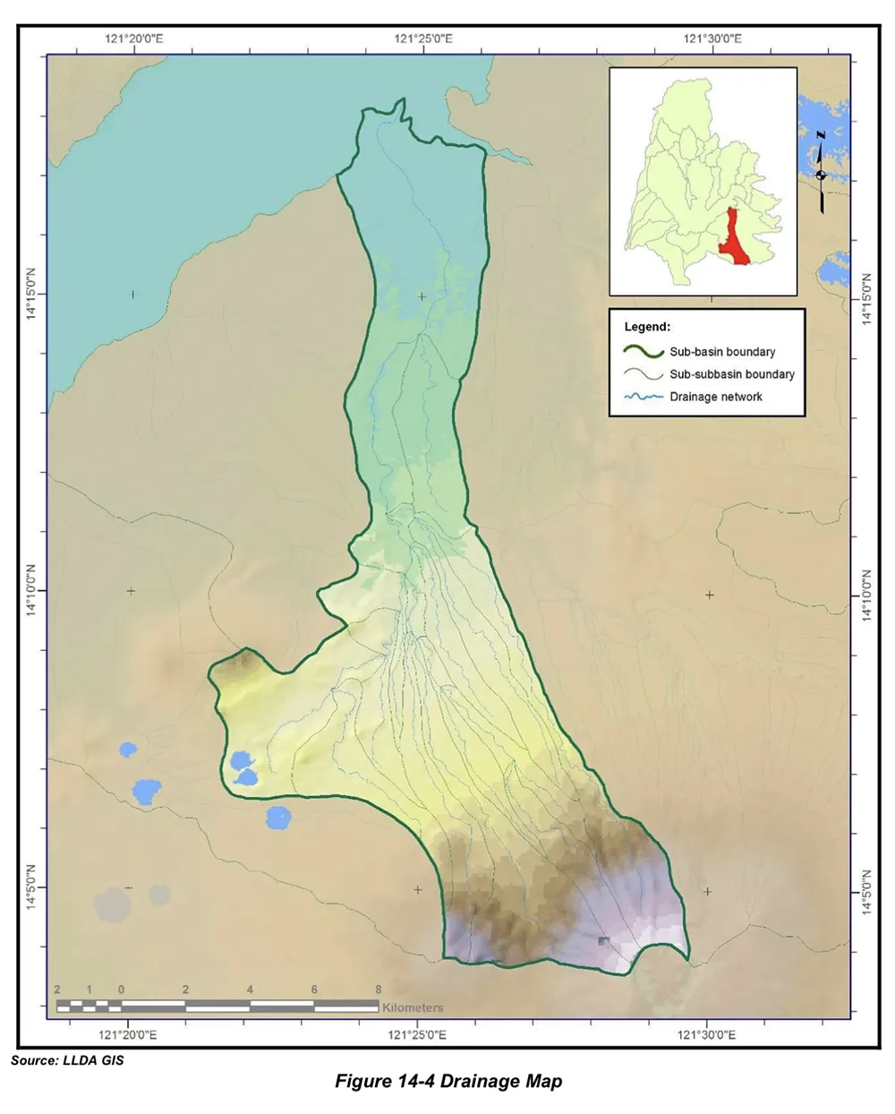
Blue-Green Infrastructures (BGIs) are interconnected networks of natural and artificial structures designed for efficient water management, along with other roles such as urban cooling and flood mitigation, with marginal side effects. Blue-Green Infrastructures are praised for being climate-resilient infrastructures, which are especially warranted in the Philippines, whose geographic location, compounded by climate change, increases its exposure to extreme weather events. This study aims to evaluate the performance of Blue-Green Infrastructures as flood mitigation measures in the Sta. Cruz River Basin (Figure 5), a subbasin of the greater Pasig-Marikina-Laguna de Bay Basin. A geospatial and socio-economic approach will be utilized to identify potential locations for the implementation of Blue-Green Infrastructures in the watershed, while their performance will be evaluated using the Soil Water Assessment Tool (SWAT) Model on a ten-year climate and land use projection. The study is expected to yield the following outputs: (1) a map showing the suitability of Blue-Green Infrastructures in the area; (2) a calibrated model displaying the surface runoff in the basin with and without the implementation of Blue-Green Infrastructures; and (3) a criteria for choosing the most appropriate Blue-Green Infrastructure component in the watershed.
References
Laguna Lake Development Authority. 2012. The Hydrologic Atlas of the 24 Sub-Basins of Laguna de Bay 2012. The Sta. Cruz Watershed.
Torrefranca, I, and Otadoy, R E. 2022. GIS-based watershed characterization and morphometric analysis in Bohol Watersheds, Philippines. Geology, Ecology, and Landscapes, 8(4), 527-538. DOI: 10.1080/24749508.2022.2158554
UP Training Center for Applied Geodesy and Photogrammetry. 2015. DREAM ground surveys for Hijo River. University of the Philippines.